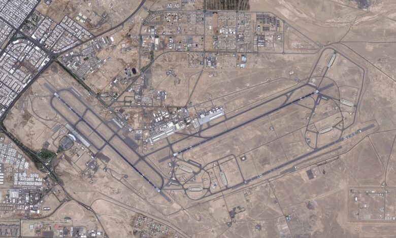
The New York Times revealed new pressures exerted by US President Donald Trump’s administration on commercial satellite companies to withhold high-resolution imagery of conflict zones—particularly in the Middle East.
The move has raised concerns about restricting the ability of journalists, researchers, and humanitarian organizations to document the aftermath of military operations and verify official narratives, after such imagery helped expose damage from US strikes that hit schools and homes in Iran.
In a visual report published on Wednesday titled “What We Lose When Satellite Images Are Blocked,” the newspaper noted that satellite imagery has helped document destruction in the Gaza Strip, mass graves in Ukraine, detention camps in China, and the attack on a school in the Iranian city of Minab.
The report noted that during the early days of the war with Iran, satellite photos revealed details of US missile strikes hitting civilian targets, as well as damage to American bases that exceeded what the Trump administration had acknowledged.
According to the Times, Planet Labs, a major satellite imaging firm, notified its clients that it was restricting access to imagery at the request of the US government.
Vantor had previously begun enforcing similar restrictions, stating it was adhering to its internal policies.
These restrictions have expanded to cover wide areas of the Gulf, Gaza, and Lebanon—including areas where US forces are not officially stationed—despite the companies’ heavy reliance on government contracts.
At the same time, the report noted that administration officials and members of Congress have voiced concerns that Iran could use commercial imagery to locate and target US forces, prompting Washington to press the companies to tighten restrictions.
The report also reviewed a tool developed in 2023 to monitor destruction in Gaza using imagery from the European Space Agency alongside high-resolution US commercial photos.
Current restrictions hinder the ability to identify the nature of destroyed buildings and the weapons used, the report stressed, warning of the consequences for investigating potential war crimes, monitoring Iran’s nuclear program, assessing the needs of displaced persons and refugees, evaluating camp safety, and tracking deforestation in the Amazon via machine learning.
Additionally, the New York Times reported that the House Intelligence Committee has asked the Department of Defense and the Director of National Intelligence to draft a new plan to regulate satellite companies holding government contracts, a step that could broaden oversight powers.
Experts have warned that these restrictions could weaken the competitiveness of American firms in favor of Chinese rivals without achieving the intended security goals.