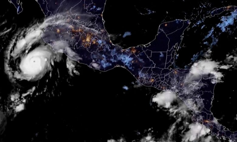
Hurricane Roslyn slammed into west-central Mexico on Sunday morning, bringing dangerous storm surge and flooding to parts of the country, forecasters said.
Roslyn made landfall around 7:20 a.m. ET near Santa Cruz in northern Nayarit state.
The storm hurled maximum sustained winds of 120 mph, according to the Miami-based National Hurricane Center.
Roslyn is forecast to rapidly weaken Sunday as it pushes inland over the mountainous terrain of western Mexico.
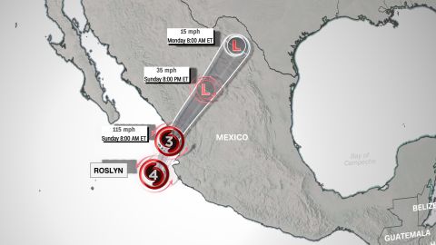
A hurricane warning is in effect for Islas Marias – an archipelago roughly 60 miles off the mainland coast – and for the region from Playa Perula to Escuinapa. A hurricane watch is in effect for the area north of Escuinapa to Mazatlan.
“Preparations to protect life and property should be rushed to completion,” the National Hurricane Center said.
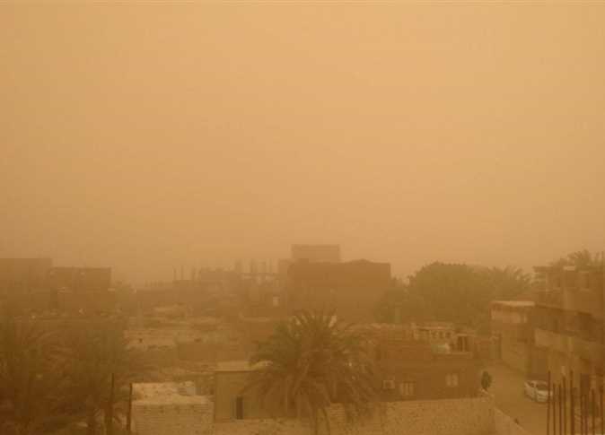
Significant rainfall is also expected, which could lead to flash flooding and landslides, according to the forecast.
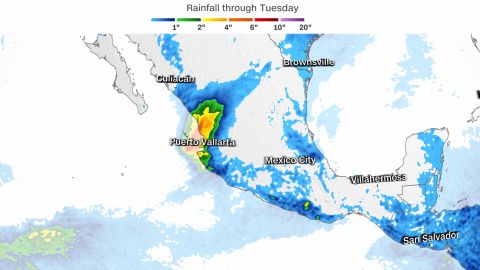
Colima’s upper coast, western Nayarit, including Islas Marias, and southeastern Sinaloa could see up to 8 inches of rain. Jalisco could get a maximum of 10 inches along the northern coast.
Roslyn formed off the western coast of Mexico and its sustained wind speed increased by 60 mph in a 24-hour period from Friday to Saturday morning – a rapid intensification.
The hurricane has been tracking similarly to Hurricane Orlene, which made landfall October 3 just north of the Nayarit-Sinaloa border as a Category 1 storm before dissipating further inland. Orlene had strengthened into a Category 4 storm over open waters the day prior.
CNN’s Haley Brink and Derek Van Dam contributed to this report.