The Egyptian Meteorological Authority (EMA) forecasts a drop in temperatures across Egypt until Monday, as the country experiences a severe cold wave due to the expansion of the Siberian High originating from eastern Russia.
Egypt will see a significant drop in temperatures across the country, especially during the early morning and late night hours, with snow expected on the peaks of the Saint Catherine Mountains in South Sinai.
This high-pressure system is a key feature of the winter season and plays a major role in pushing extremely cold polar winds towards the region.
The impact of this high-pressure system extends to the Middle East, with the Arab countries most affected by this cold wave being: Lebanon, Syria, Iraq, Saudi Arabia, Qatar, Jordan, Palestine, Egypt, and Kuwait.
Wednesday’s weather forecast
The EMA warned of fog formation on some roads leading to and from northern Egypt, including Greater Cairo, northern Upper Egypt, and central Sinai.
This fog may reduce horizontal visibility in areas along the northern coast and the Lower Egypt.
The EMA urged extra vigilance on roads, maintaining safe distances between vehicles, and partially opening car windows to prevent fog formation.
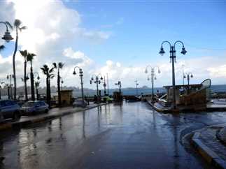
There will be a chance of light to moderate rain in areas along the northern coast, northern Lower Egypt, and as far south as Halayeb and Shalateen, at intervals.
Expected temperatures for Wednesday:
- Cairo: 23C
- Alexandria and Hurghada: 24C
- Matrouh: 25C
- Sharm El-Sheikh: 26C
- Luxor: 28C
- Aswan: 30C
Edited translation from Al-Masry Al-Youm